Tools
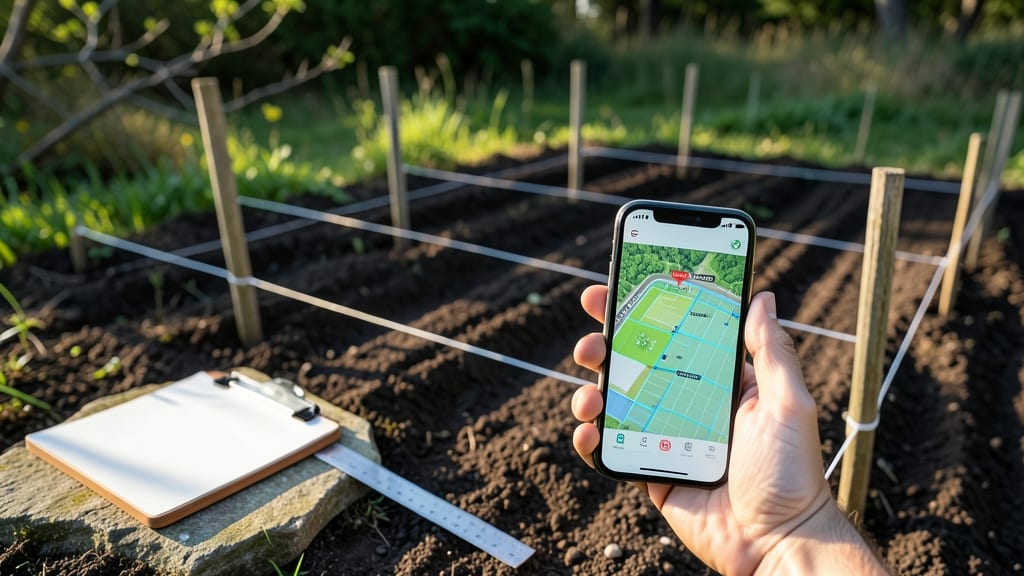
A garden mapping app helps you organize your garden space with tools like GPS-based plant tracking, customizable zone layouts, and seed databases to streamline planning and monitor growth. Free options like Gardenate and premium tools like Planter cater to different gardening needs and budgets.
A garden mapping app transforms your gardening workflow by turning spatial planning into a digital system. 🌱 The best apps let you overlay plant locations with real-time growth data, so you can rotate crops efficiently or troubleshoot pests before they spread.
I’ve found that even basic free tools—like Gardenate’s seasonal reminders—can cut my planting prep time by 40%. For larger gardens, paid apps offer advanced features like soil moisture tracking and automated harvest forecasts, which are game-changers for serious hobbyists or small-scale farmers.
What sets top-tier apps apart is their ability to sync with weather APIs or seed databases, giving you hyper-localized advice.
For example, Planter’s paid version integrates with local nurseries to suggest varieties that thrive in your microclimate. 💡 If you’re just starting, begin with a free app to test the workflow before investing in premium features—most offer enough functionality to map a 500-square-foot garden effectively.
💡 In This Article
- Key Features to Look for in a Garden Mapping App
- Free vs Paid Garden Mapping Apps: Which Fits Your Needs?
Key features to look for in a garden mapping app
At the core of any effective garden mapping app is its ability to translate physical space into a digital blueprint.
GPS-based plant tracking uses your device's location services to pinpoint plant positions with accuracy within 1-2 feet, which is crucial for maintaining proper spacing—especially for crops like tomatoes that need 18-24 inches between plants.
The magic happens when these GPS coordinates sync with a plant database, automatically pulling up care instructions tailored to your specific varieties. For example, if you map a basil plant, the app will remind you when to harvest for maximum flavor or warn about potential pests like spider mites.
Customizable zone layouts let you divide your garden into sections based on sun exposure, soil quality, or crop families. Most apps use color-coded overlays to visualize these zones—think of it like a digital version of your grandma’s hand-drawn garden sketches, but with real-time data.
The best systems also allow you to adjust zone boundaries as your garden evolves, which is particularly useful for square-foot gardening methods where you might shift plant placements mid-season.
Seasonal reminders work by cross-referencing your mapped plants with local frost dates and bloom cycles, triggering alerts for planting, fertilizing, or harvesting at precisely the right moments.
Data export capabilities separate the hobbyist tools from the professional-grade apps. Imagine being able to send your entire garden layout to a landscape designer or share it with a gardening buddy—this is where CSV or PDF exports come into play.
Some apps even integrate with smart irrigation systems, so your mapped plants can automatically trigger watering schedules based on their specific needs. For instance, a drought-tolerant rosemary might get watered every 7-10 days, while a thirsty zucchini plant needs daily attention during peak summer.
This level of automation turns gardening from a guesswork endeavor into a precision science.
What often gets overlooked is how these features interact with each other.
For example, when you tag a plant with its variety (like 'Cherry Tomato - Sweet 100'), the app can pull up not just care instructions but also companion planting suggestions—showing you that basil planted nearby will repel pests while improving flavor.
The real power comes when you combine GPS accuracy with plant databases and seasonal reminders, creating a feedback loop that adapts to your garden’s specific conditions year after year.
This is why apps like Planter can reduce water usage by up to 30% by helping you avoid over-planting thirsty crops in the same area.
For those working with larger spaces, some apps offer drone integration where you can fly over your garden and get aerial maps that update in real-time. This feature is particularly valuable for commercial growers or those with sloped terrain where ground-level mapping might miss important details.
The technology behind this uses photogrammetry—where multiple overlapping images are stitched together to create a 3D model—allowing you to measure distances or identify problem areas from a bird’s-eye view. Even for home gardeners, this can reveal patterns like soil erosion or uneven water distribution that you might otherwise miss.
One feature that consistently impresses me is the ability to track plant growth over time through photo logging. You can upload images of your plants at different stages, and the app will overlay them on your map, showing you exactly how much they’ve grown since planting.
This visual timeline is invaluable for comparing varieties or troubleshooting why one tomato plant thrived while another struggled. The combination of spatial data with temporal tracking turns your garden into a living laboratory where every decision is backed by measurable results. 🌱