Tools
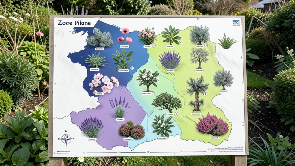
To determine your UK garden zones, use the Royal Horticultural Society's hardiness map, which categorizes the UK into 10 zones based on winter temperatures and frost exposure. This classification helps you select plants best suited to your local climate.
The UK's 10 garden zones reflect average minimum winter temperatures and frost frequency, with Zone 1 (coldest) covering Scotland and Zone 10 (mildest) including Cornwall. 🌿 These zones help gardeners match plants to their region's climate—evergreens thrive in milder zones, while hardy perennials suit colder areas.
The RHS map also accounts for microclimates, like sheltered urban spots that may be 1-2 zones warmer than surrounding areas.
For practical use, check your postcode on the RHS website to pinpoint your exact zone. This knowledge directly impacts planting success: Zone 8 plants (like lavender) may freeze in Zone 5, while Zone 10's subtropical choices (e.g., bougainvillea) won't survive northern winters.
Always verify plant labels against your zone to avoid costly mistakes.
💡 In This Article
- Understanding UK Garden Zones and Plant Hardiness
- Practical Tips for Using UK Garden Zones in Plant Selection
Understanding UK garden zones and plant hardiness
The Royal Horticultural Society (RHS) divides the UK into 10 distinct garden zones based on average minimum winter temperatures and frost frequency.
Each zone represents a 5°F difference in cold tolerance, with Zone 1 (coldest) experiencing below -15°F (-26°C) winters, while Zone 10 (mildest) rarely dips below 15°F (-9°C).
This system helps gardeners match plants to their local climate by accounting for hardiness thresholds—the temperature at which plants sustain damage or die.
Scotland and northern England typically fall into Zones 1-4, where frost can last 120-150 days annually, while Cornwall and southern England occupy Zones 8-10, with frost-free periods extending 200+ days.
The RHS also factors in microclimates—urban areas with buildings can be 1-2 zones warmer than rural spots due to the "urban heat island" effect, where concrete and asphalt retain heat. For example, a garden in Zone 5 might shelter Zone 6 plants near a south-facing wall.
Interpreting the map involves checking your postcode on the RHS website, which overlays your location onto the zone boundaries. The map uses color-coded shading to visualize temperature gradients, with darker blues indicating colder zones.
This visual tool helps gardeners adjust planting schedules—for instance, Zone 8 allows subtropical plants like bougainvillea to thrive, while Zone 3 requires hardy perennials like heather or snowdrops that survive -20°F (-29°C).
Seasonal planting relies on these zones too. In Zone 1, gardeners plant cold-hardy vegetables (e.g., kale, Brussels sprouts) in early spring, while Zone 10 supports year-round tropicals like citrus trees. The RHS also provides frost-free dates for each zone, guiding when to sow tender seeds.
For example, Zone 5 may see its last frost in mid-May, while Zone 9 can plant heat-loving tomatoes as early as March.
Microclimates add complexity—south-facing slopes can be 2-3 zones warmer than north-facing areas, allowing gardeners to push plant limits. For example, a Zone 6 gardener might grow Zone 7 lavender in a sheltered microclimate but lose it in a frost pocket.
Always verify plant labels against your zone to avoid costly mistakes, especially with tender perennials or exotic species.
Why does this matter? Plants evolved in specific climates, and hardiness zones act as a survival guide. A Zone 8 rose transplanted to Zone 3 will likely die in winter, while a Zone 3 peony thrives in Scotland but may struggle in Cornwall’s milder winters.
The RHS system simplifies this by standardizing climate data, ensuring gardeners make informed choices. 🌱