Blooming
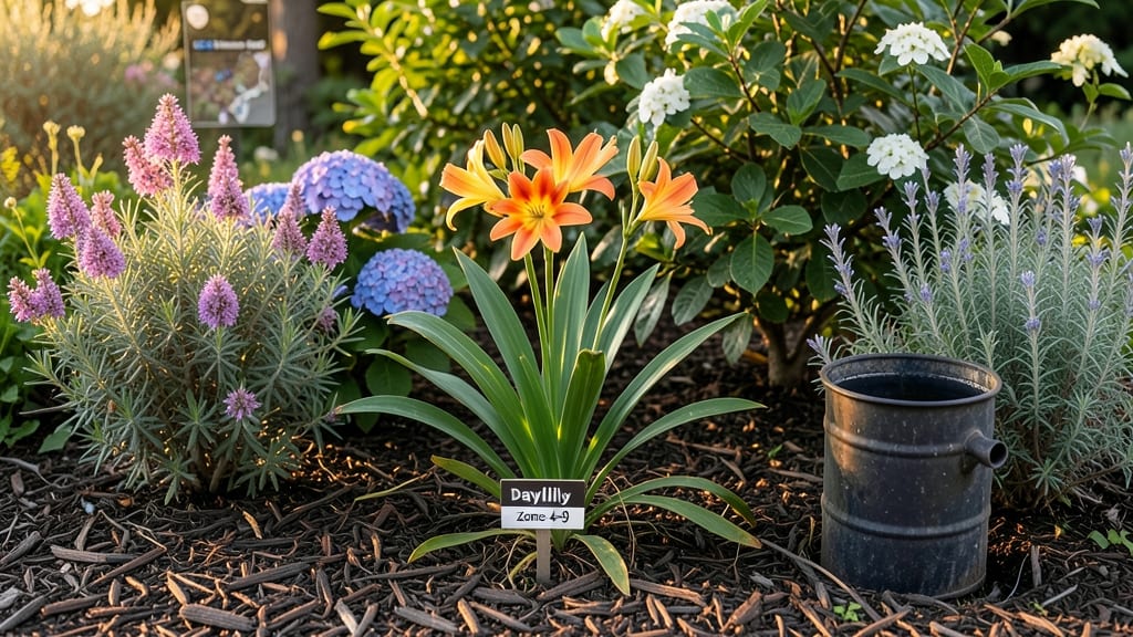
To identify your Long Island gardening zone, start with the USDA Plant Hardiness Zone Map, which categorizes most of the region as Zones 7b through 8a, then refine your selection by accounting for local microclimates like coastal salt exposure or urban heat pockets. Using the ZIP code tool provides precise mapping, while considering wind patterns and soil types ensures you choose plants suited to your exact growing conditions.
Long Island's gardening zones aren't just about the broad USDA classification—they're shaped by the island's unique geography. 🌊 Coastal areas, especially on the South Shore, experience salt spray that can damage sensitive plants, while inland zones like the North Fork often have cooler nights.
The Cornell Cooperative Extension offers local soil tests to help you adjust for these variations, which can shift your effective zone by up to 2 degrees. For example, a garden in Montauk might thrive with Zone 8 plants, while one in Central Islip could handle Zone 7 varieties without issue.
Beyond the map, microclimates play a huge role. Urban areas like Huntington can be 5-10°F warmer than rural spots due to pavement and buildings, while windbreaks made of hedges or fences can create sheltered microclimates perfect for heat-sensitive plants.
I always recommend testing your soil's pH and drainage—Long Island's sandy soils drain quickly but may lack organic matter, which affects plant health just as much as the zone number does.
💡 In This Article
- USDA Plant Hardiness Zones on Long Island: Exact Boundaries and Microclimate Factors
- Practical Tools and Adjustments for Long Island Gardeners
USDA plant hardiness zones on Long Island: exact boundaries and microclimate factors
The USDA Plant Hardiness Zone Map divides Long Island primarily into Zones 7b (average minimum temperatures of 5-10°F) and 8a (10-15°F), with the North Fork generally cooler than the South Shore.
This division stems from Long Island's 40.5°N latitude, where the Gulf Stream moderates coastal temperatures while inland areas experience more continental climate swings. The 10°F difference between zones might seem small, but it determines whether you can grow peaches (Zone 8) or only apples (Zone 7).
Coastal exposure creates dramatic variations—salt spray from the Atlantic can damage sensitive plants like hydrangeas, while wind patterns shift with seasons. For example, Montauk's Zone 8a classification belies its harsh coastal winds, which can make growing conditions more akin to Zone 7 for delicate species.
The North Fork's Zone 7b areas often have cooler nights due to maritime influence, while urban pockets like Huntington can reach 5°F warmer than rural zones thanks to the "urban heat island" effect.
Soil composition adds another layer: Long Island's sandy loam drains quickly but lacks organic matter, creating dry microclimates where plants need 10-20% more water than in clay-heavy soils.
The Cornell Cooperative Extension reports that coastal gardens often have higher pH levels (6.5-7.5) due to salt deposition, requiring acid-loving plants like blueberries to be grown in raised beds with peat moss. These factors mean your actual "growing zone" might differ by 1-2 zones from the USDA map.
Here's how to visualize it: Imagine a gradient from Montauk Point (Zone 8a) to Central Islip (Zone 7b), with the South Shore generally 1°F warmer than the North Fork.
The Great South Bay creates a buffer zone where salt-tolerant plants like sea lavender thrive, while inland areas can support tropicals like bougainvillea for brief periods. The key is understanding these 1-2°F shifts—they're the difference between a thriving garden and a struggle.
For precise mapping, use the USDA ZIP code tool—it accounts for elevation changes (though Long Island's 100-200 ft elevation range has minimal impact) and local weather data from the past 30 years.
But always cross-reference with Cornell's Long Island Soil Survey, which shows how sandy soils (common in Suffolk County) heat up faster than loam soils (more prevalent in Nassau), affecting planting times by 1-2 weeks.
What most gardeners miss is how windbreaks can create artificial microclimates. A 6-foot tall hedge can reduce wind speed by 50% in the leeward zone, allowing you to grow Zone 8 plants in an otherwise Zone 7 area.
Similarly, black plastic mulch raises soil temps by 5-8°F, extending the growing season for heat-lovers like tomatoes by 2-3 weeks. These adjustments turn the USDA zone from a starting point to a customizable framework.
Remember: The USDA map is a baseline. Your actual growing conditions depend on 50% location (coastal vs inland), 30% soil, and 20% microclimate tweaks. Start with the map, then observe how your specific yard behaves—especially during January lows and July highs.
That's where you'll find your true gardening zone. 🌱